
A humanoid that learns to copy people walking and climbing on real ground has to deal with that ground. We measured the ground of one park from the same drone video as the motion, trained a Unitree G1 on it and on a flat floor, and tested both on the measured ground.
In short. A Unitree G1 trained on the measured ground of a real park, its slopes and a levee, fails about 12 of 210 clips in physics simulation. Trained on a flat floor with the same training setup, it fails about 31. Both are tested on the measured ground, with 3 training seeds per arm and 5 evaluations per clip, and the 95% confidence intervals do not overlap (3.0–8.6% against 10.5–19.0%). It held on a larger set of 323 clips, with a smaller gap.
Every seed points the same way: the measured-ground policies fail 6.0%, 5.0%, 5.7% of clips, the flat-floor policies 14.3%, 14.7%, 14.9%. The measured-ground policy also follows the person’s motion more closely, 5.5 cm local joint error against 6.4 cm.
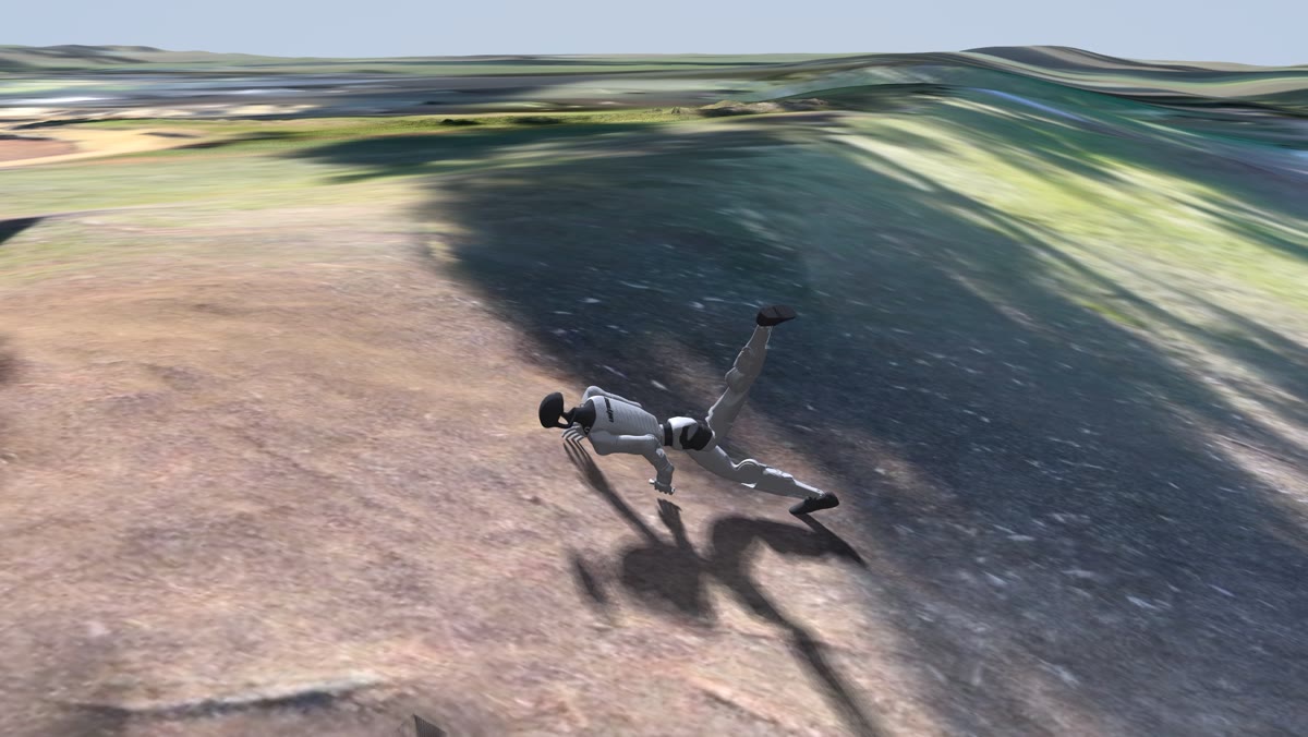
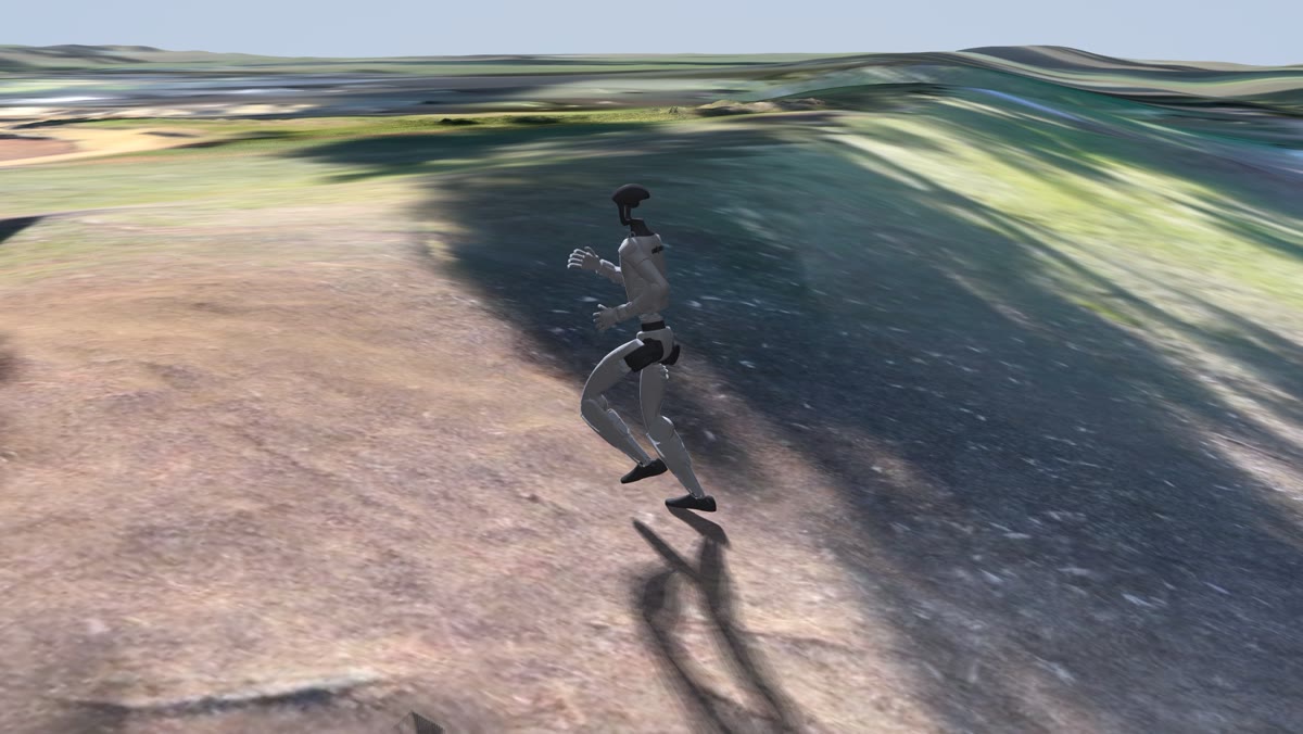
One clip, two policies
On the levee bank the flat-floor policy loses its footing within the first second and is on the ground soon after. The measured-ground policy runs the whole clip.
A larger set
We repeated the comparison on a larger, overlapping set of 323 clips from the same afternoon, with the same training budget, seeds and evaluations. The direction held on every seed with a smaller gap: 9.9% of clips failed for the measured-ground policy against 15.6% for the flat-floor one, and the confidence intervals touch (7.1–13.1% against 12.1–19.3%).
Where the ground comes from
Each clip is trained on a tile of ground around the person’s path. Where the drones saw the path, the ground is measured from the drone video, and it agrees with public survey lidar to about 4 cm at the 90th percentile (median over the 62 clips that have it). Where they did not, the tile is the public USGS 1 m lidar. That is the case for 148 of the 210 clips, so “measured ground” on this page means drone-measured where available and survey lidar elsewhere.
drone-measured on the pathpublic survey lidar only
How it was trained and tested
| Motion | 210 clips of 4 seconds of one person walking, jogging, jumping and climbing slopes and a levee, from Capture 03, retargeted to a Unitree G1 |
|---|---|
| Training | World-model training in the style of SuperMimic (Liao et al., CoRL 2026). 6,400 iterations per run on one GPU, the same for both arms; 3 seeds per arm |
| Arms | Trained on the measured ground of each clip, or on a flat floor. Same clips, same budget, same training settings |
| Test | Both arms on the measured ground, every clip 5 times from slightly randomised starts. A run fails when the robot falls or drifts away from the person’s motion |
| Statistics | Failure rate over clips × seeds, 95% bootstrap confidence intervals |
Both arms are tested on the measured ground on purpose. On a flat floor, a motion recorded on a slope cannot be followed at all: the person climbs a metre, the floor does not, and the reference leaves the robot behind. Scoring the flat-floor policy there would count those clips against it for the wrong reason.
Credits
- SuperMimic: Liao et al., CoRL 2026 (arXiv 2610.28480). We trained in the style of the paper; the comparison of training grounds is ours.
- Ground: USGS 3D Elevation Program lidar (public domain) and our own drone capture. Robot: Unitree G1. Physics: MuJoCo.
- Footage: Capture 03, October 17, 2026. The person filmed consented to capture and publication; other park visitors are erased from the footage, not blurred.
More from the same afternoon: Capture 03. Numbers on this page are generated from the result files and checked against them at build time.